
| Home Return to Long Island Genealogy |
Email |
| Home Return to Long Island Genealogy |
Email |
|
|
|
| 1. Long
Island Records |
2. Surname
Databases |
3. Long Island
Reference Books on CD |
4. SITE SEARCH |
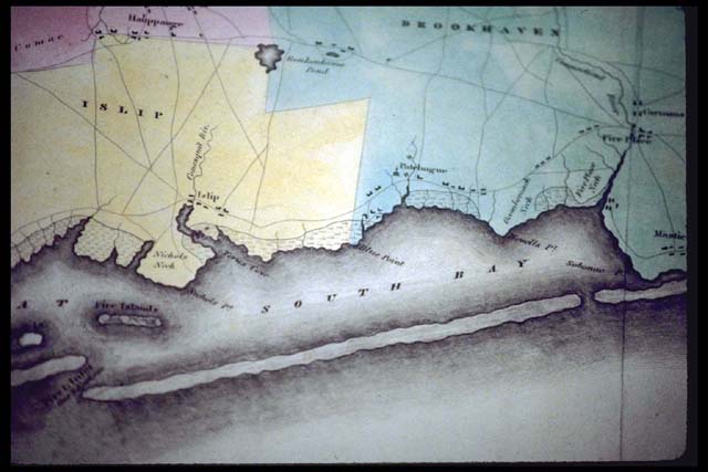
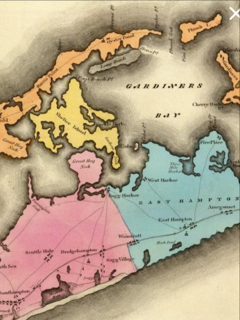
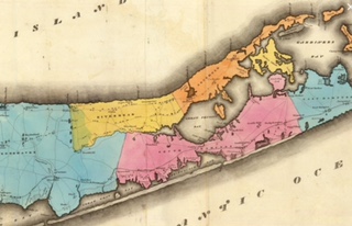
| Map including
Bridgehampton and Gardiners island |
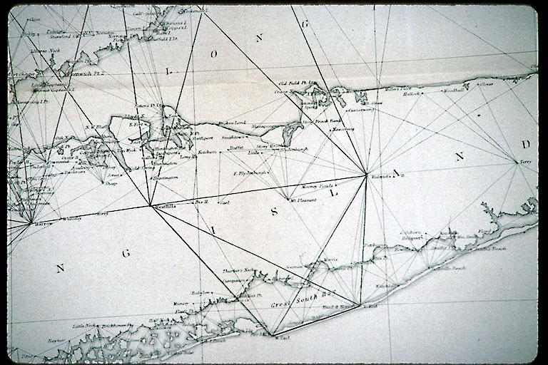
Early map south
fork of Long Island |
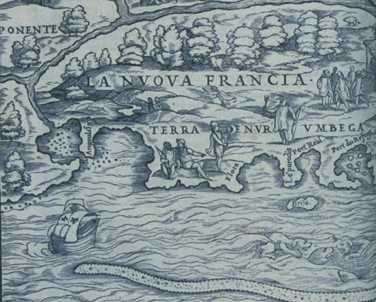
Giacomo di Gastaldi [New France], 1556. Detail showing Long Island as "Flora." (John Carter Brown Library at Brown University.) |
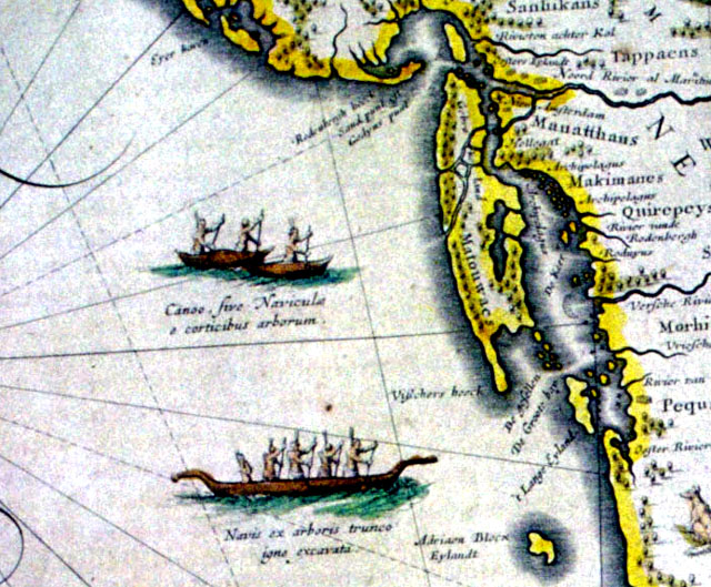
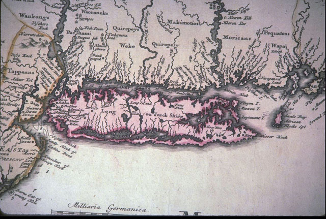
William Janzoon Blaeu, New Belgium and New England , 1635. Detail showing Long Island and Natives in canoes. (SUNY Stony Brook.) |
Anonymous, Manhattan on the North River, 1639. Detail showing Dutch settlements on Manhattan and Native longhouse in Brooklyn. (Library of Congress, Geography and Map Division.) |
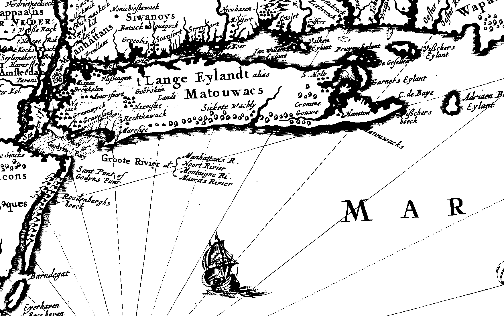
Nicholaes Visscher, New Belgium and New England, 1656 Detail from a facsimile showing Long Island. (State University of New York at Stony Brook.) |
Arendt Roggeveen, Map of New Netherland, 1675. Detail showing Long Island. (Library of Congress, Geography and Map Division.) |
John Seller, A Chart of the Sea Coasts of New-England, New Jarsey, Virginia, Maryland and Carolina--from C. Cod to C.Hatteras, 1675. Early English map influenced by Dutch maps and by John Scott map. (New York State Library.) |
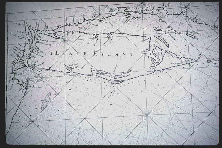
Robert Ryder, Long Island Sirvaide by Robartte Ryder, [1674]. First map of Long Island based on an actual survey. (John Carter Brown Library at Brown University.) |
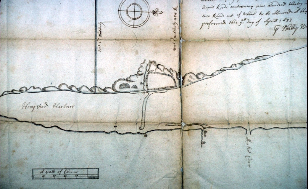
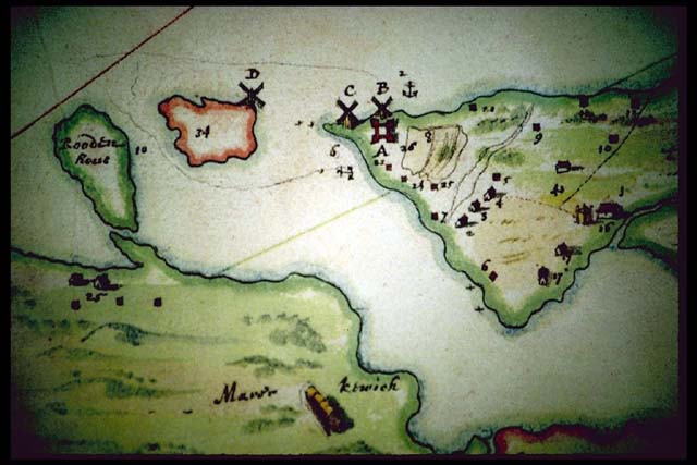
Philip Welles, [Draught of a Tract of Land on the East Side of Cow Neck on Long Island], 1683. Map of Hempstead Harbor showing property boundaries and possible Native wigwams. (New York State Archives.) |
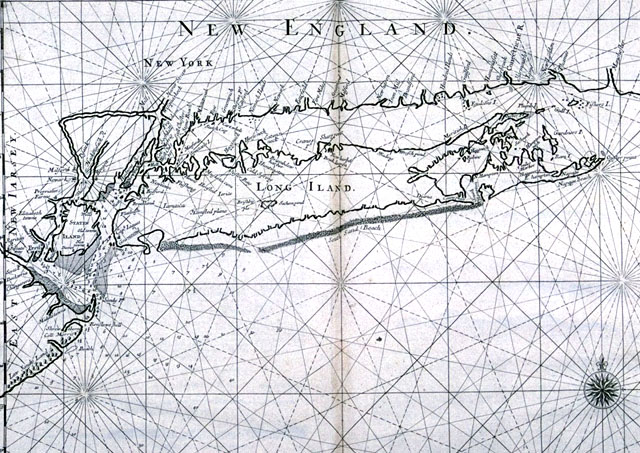
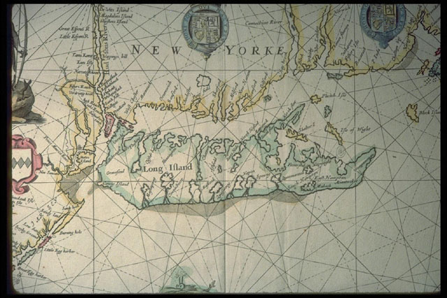
John Thornton, Part of New England, New York, East New Iarsey, and Long Island, 1689. Famous nautical chart based in part on the Ryder map. (Original Possessed by John Carter Brown Library at Brown University.) |
Robert Morden, A Map of ye English Empire in the Continent of America, 1690. Detail showing whaling off the coast of Long Island. (Original Possessed by the New York Public Lbrary.) |
Johann Baptista Homann, New England in North America, 1710. Detail showing Long Island; copied from a variety of Dutch maps. (Courtesy New York State Library) |
Cyprian Southack, A Map of the Coast of New England, [1730]. Detail showing an elongated Long Island. (Original Possessed by Library of Congress, Geography and Map Division) |
Jacques Nicolas Bellin, Map of New England, 1757. One of the many 18th-century British and French maps showing influence of Southack. (Original Possessed by John Carter Brown Library at Brown University) |
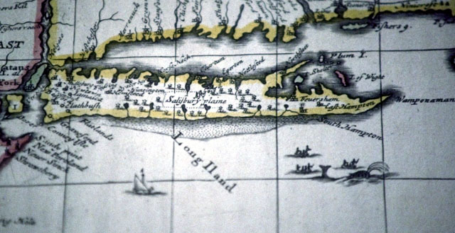
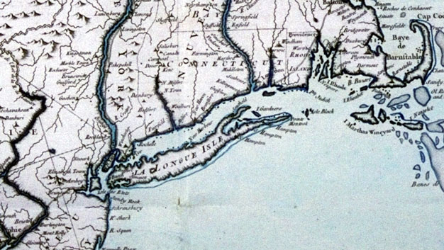
Thomas Jefferys, A Map of the Most Inhabited Part of New England, 1755. Detail showing Long Island. The model for most maps showing Long Island as a whole between 1755 and the De Witt map of 1802. (Library of Congress, Geography and Map Division.) |
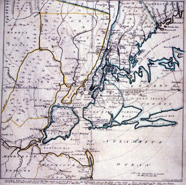
John Montresor, A Map of the Province of New York, 1775. Southern sheet showing Long Island. Based on previous map, but shows some additional details on western Long Island. (Library of Congress, Geography and Map Division.) |
Anonymous, The Country Twenty-five Miles Round New York, Drawn by a Gentleman from from That City, 1777. Shows western Long Island at the time of the Battle of Long Island. (Library Company of Philadelphia.) |
J.F.W. Des Barres, A Sketch of the Operations of His Majesty's Fleet and Army under the Command of the Rt. Hble. Lord Viscount Howe and Genl. Sr. W,. Howe, K.B., in 1776, [1778]. Shows movement of troops at the Battle of Long Island. (New York Public Library.) |
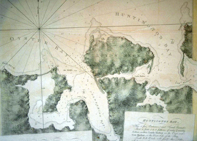
J.F.W Des Barres, Oyster Bay and Huntington, 1778. Detail showing area around Huntington. (Courtesy New York Public Library.) |
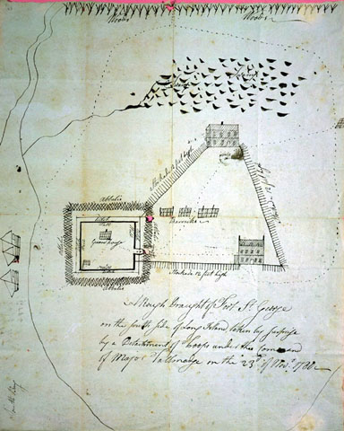
[Benjamin Tallmadge?], A Rough Draught of Fort St. George on the South Side of Long Island, [1780?]. Shows British fort in southern Brookhaven captured by the Americans under the command of Tallmadge. (Connecticut Historical Society.) |
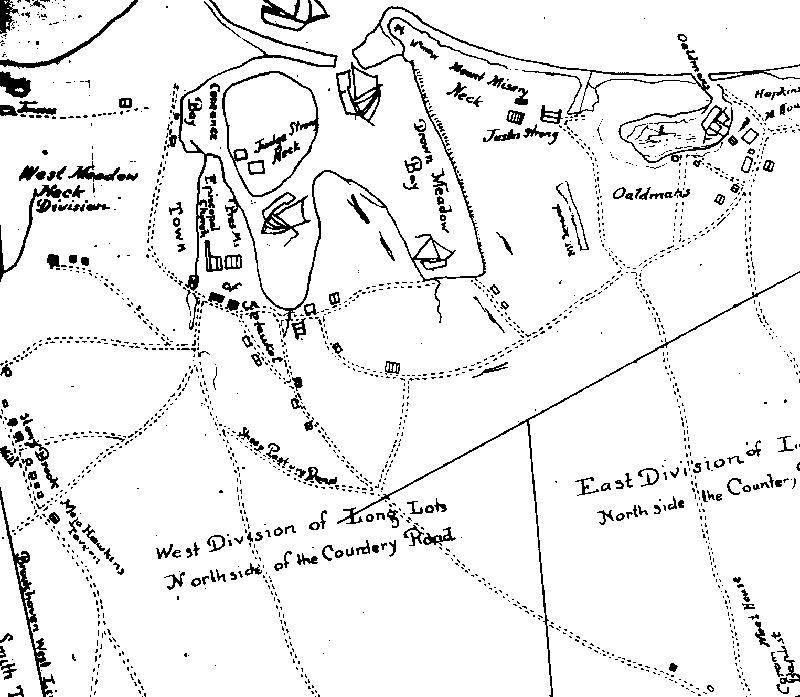
Isaac Hulse, "Map of the Town of Brookhaven, in the County of Suffolk," 1797. Detail of area around Port Jefferson. One of a series of town maps drawn up at the end of the eighteenth century as a result of a law passed by the New York State Legislature. (State University of New York at Stony Brook.) |
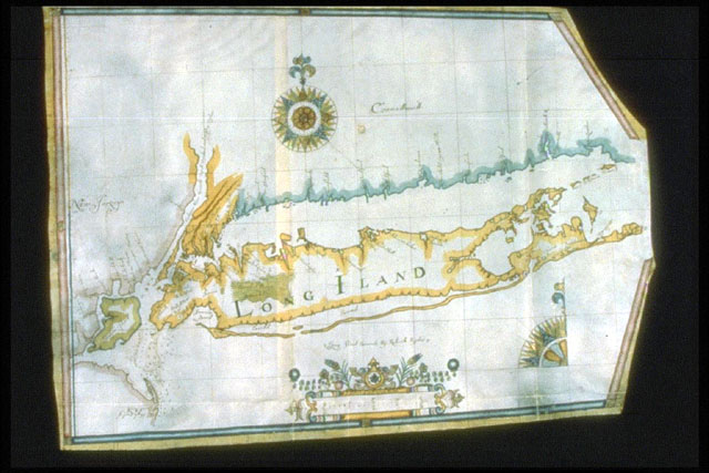
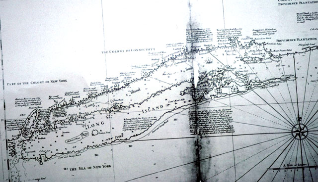
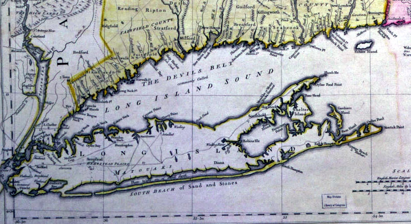
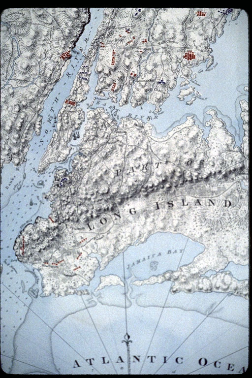
Simeon De Witt, A Map of the State of New York, 1802 [southern Sheet]. First American map of Long Island to improve on British revolutionary war era maps. (Original Possessed by Library of Congress, Geography and Map Division.) |
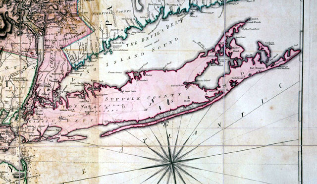
David Burr, part of "Map of the County of Suffolk," from his Atlas of the State of New York, 1829. Detailed map based on surveys by DeWitt. (State University of New York at Stony Brook.) |
Edmund Blunt, Long Island Sound from New York to Montauk Point, Surveyed in the Years 1828.29.30., 1830. Detail showing western end of Long Island Sound. (Library of Congress, Geography and Map Division.) |
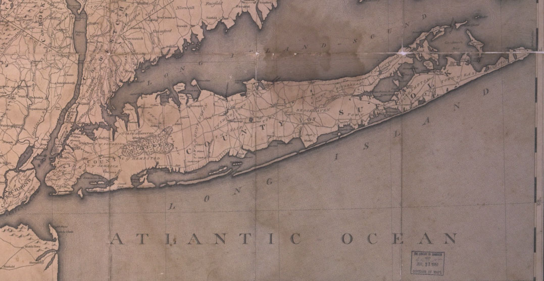
U.S. Coast Survey, Sketch B., No. 2, Showing the Triangulation & Geographical Positions in Section No. II from New York City to Point Judith, 1851. Shows base line on Fire Island and triangulation network used in first survey by U.S. government. (State University of New York at Stony Brook.) |
U.S. Coast Survey, Detail of a Manuscript map showing Huntington area, 1837. (State University of New York at Stony Brook.) |
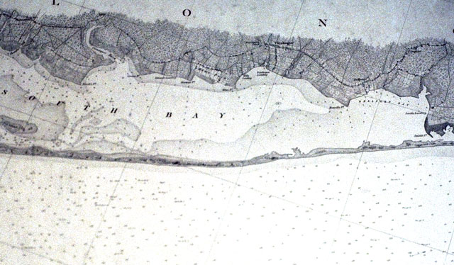
U.S. Coast Survey, Middle Part of the Southern Coast of Long Island, 1857. Detail from a published Coast Survey map. (State University of New York at Stony Brook.) |
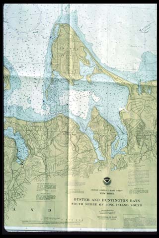
U.S. National Ocean Survey, Oyster and Huntington Bays, 1996. Modern nautical chart made by the National Oceanic and Atmospheric Administration, the successor agency to Coast Survey. (State University of New York at Stony Brook.) |
J. Chace, Map of Suffolk County,1858. Detail showing area near Southampton. (State University of New York at Stony Brook.) |
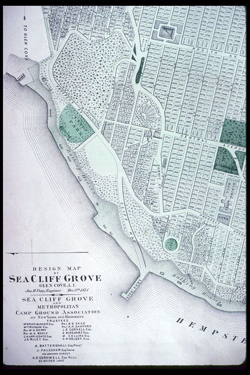
F.W. Beers, Atlas of Long Island, New York, 1873. Plate showing plan for community of Sea Cliff Grove. (Original Possessed by State University of New York at Stony Brook.) |
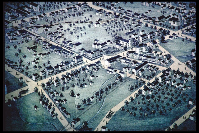
Fowler and Bulger, Hempstead, N.Y., Long Island, 1876. Bird's-eye view. (Long Island Studies Institute, Hofstra University.) |
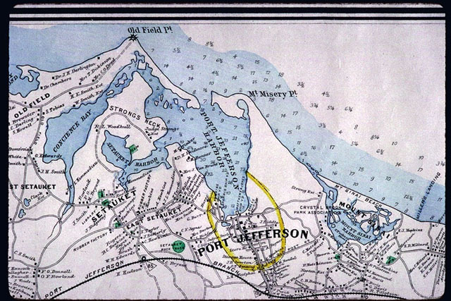
Hyde and Company, Map of Long Island, 1896. Detail of area near Port Jefferson. (State University of New York at Stony Brook.) |
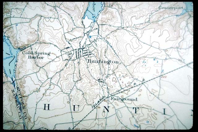
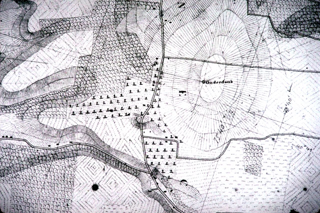
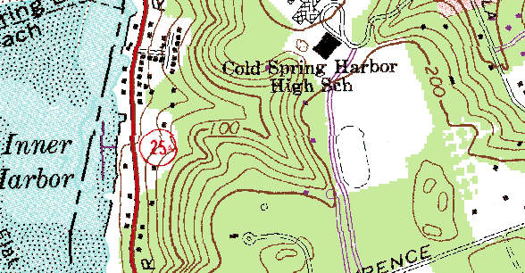
United States Geological Survey, Area around Huntington from Northport Quadrangle, 1903. Typical early U.S.G.S. 15' map. Compare with digital map of same area shown below. (State University of New York at Stony Brook.) |

United States Geological Survey, Topographic Map of Long Island New York, 1913. Detail showing eastern Long Island. (State University of New York at Stony Brook.) |
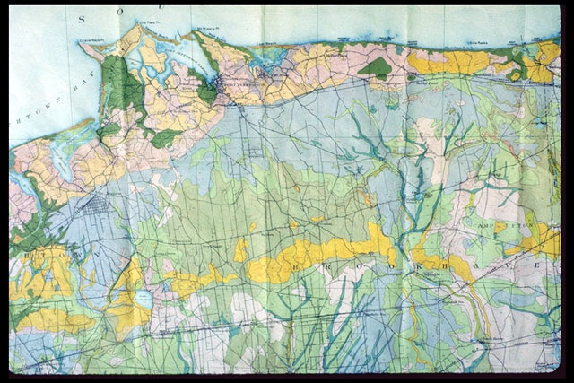
U.S. Bureau of Chemistry and Soils. Soil Map, Suffolk and Nassau Counties, 1928. Part of the largest and most colorful thematic map of Long Island. (State University of New York at Stony Brook.) |
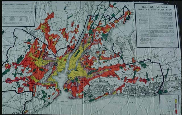
Henry I. Jebb, Jebb Guide Map, Greater New York, 1930. Real estate map showing growth of urbanized areas near New York. (State University of New York at Stony Brook.) |
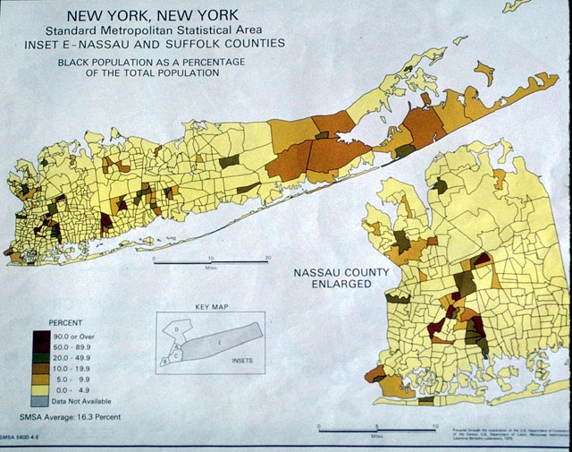
U.S. Bureau of the Census, "Nassau and Suffolk Couties: Black Population as a Percentage of the Total Population," from Urban Atlas; Tract Data for Standard Metropolitan Statistical Areas, 1974. Example of a typical computer-produced map using census data. (State University of New York at Stony Brook.) |
United States Geological Survey, Huntington Quadrangle, 1979. Detail of a small portion of a digital version of a modern topographic map. (State University of New York at Stony Brook.) |
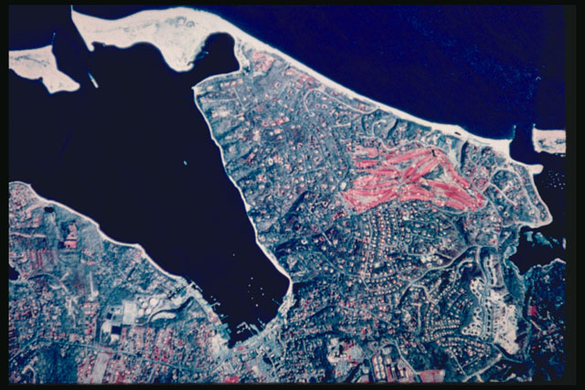
United States Geological Survey, Color aerial photograph of Port Jefferson area, 1988. Rapidly growing vegetation, such as golf courses, appears to be red. (State University of New York at Stony Brook.) |
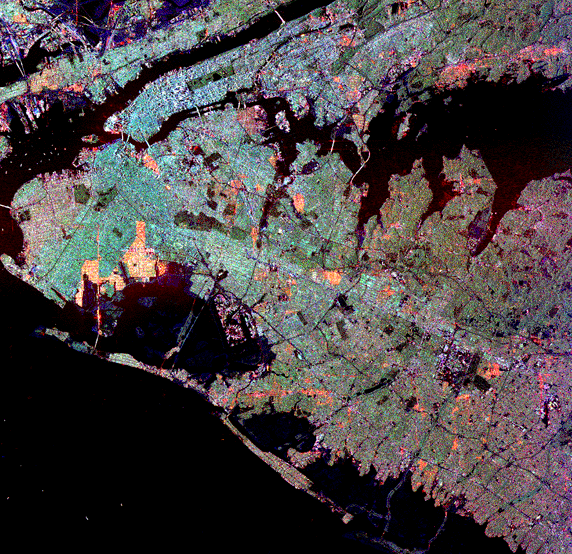
EROS Data Center, Satellite view of western Long Island. Built up areas appear to be blue in this rendition. (State University of New York at Stony Brook.) |
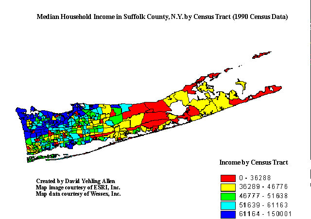
Population by Household Income in Suffolk County, N.Y. Digital map produced using data files generated by the U.S. Census Bureau. (State University of New York at Stony Brook.) |
|
|
|
to View |
| 1847 | Nautical Chart of Oyster or Syosset Bay | Image |
| 1847 | Nautical Chart of Oyster or Syosset Bay | Image |
| 1848 | Nautical Chart of Plum Island to Stratford Shoal | Image |
| 1849 | Nautical Chart for Buttermilk Channel in NY Harbor | Image |
| 1851 | Nautical Chart for Sachem's Head Harbor and Hart and City Island Harbor | Image |
| 1851 | Nautical Chart of Southern Long Island | Image |
| 1851 | Nautical Chart of Western Part of the Southern Coast of Long Island | Image |
| 1851 | Survey of Pot Rock and Ways Reef, Hell Gate | Image |
| 1853 | Nautical Chart of Romer and Flynn's Shoals, New York Bay | Image |
| 1855 | Long Island Sound | Image |
| 1855 | Nautical Chart for the Middle Part of Long Island Sound | Image |
| 1855 | Nautical Chart of the Eastern Part of Long Island Sound | Image |
| 1855 | Preliminary Chart of Hudson River | Image |
| 1857 | Nautical Chart for the Middle Part of the Southern Coast of Long Island | Image |
| 1857 | Nautical Chart of the Eastern Part of the Southern Coast of Long Island | Image |
| 1857 | Nautical Chart of the Southern Part of Long Island | Image |
| 1859 | Nautical Chart of Hempstead Harbor, Long Island | Image |
| 1859 | Nautical Chart of Hempstead Harbor, Long Island | Image |
| 1863 | Nautical Chart of the Atlantic Coast of the United States | Image |
| 1863 | Sketch of Phelps' Ledge and Great Eastern Rock off Montauk Point | Image |
| 1864 | Nautical Chart of the Atlantic Coast of the United States | Image |
| 1865 | Nautical Chart of Hudson River from New York to Haverstraw, Sheet 1 | Image |
| 1866 | Nautical Chart of New York Bay and Harbor | Image |
| 1866 | Nautical Chart of New York Bay and Harbor | Image |
| 1866 | Nautical Chart of New York Bay and Harbor | Image |
| 1866 | Nautical Chart of New York Harbor | Image |
| 1866 | Nautical Chart of New York Harbor | Image |
| 1870 | Nautical Chart for New York Harbor Entrance | Image |
| 1870 | Nautical Chart of New York Entrance | Image |
| 1874 | Nautical Chart for New York Bay and Harbor | Image |
| 1874 | Nautical Chart for the Bay and Harbor of New York | Image |
| 1874 | Nautical Chart of New York Bay and Harbor | Image |
| 1875 | Nautical Chart for the Entrance of New York | Image |
| 1875 | Nautical Chart of Hell Gate and its approaches | Image |
| 1877 | Nautical Chart for the Southern Coast of Long Island | Image |
| 1877 | Nautical Chart of the Southern Coast of Long Island from East Hampton to Moriches Bay | Image |
| 1878 | Nautical Chart of Long Island Sound with Continuation to New York | Image |
| 1878 | Preliminary Chart of Hudson River from Haverstraw to Poughkeepsie, Sheet 2 | Image |
| 1880 | General Chart of the Coast from Cape Ann to Gay Head | Image |
| 1880 | Map of the Southern Coast of Long Island from Montauk Point to East Hampton | Image |
| 1880 | Nautical Chart for Fire Island Inlet, NY | Image |
| 1883 | Nautical Chart for the Entrance to New York Bay | Image |
| 1883 | Nautical Chart of Long Island Sound | Image |
| 1883 | Nautical Chart of Long Island Sound | Image |
| 1883 | Nautical Chart of Long Island Sound from Stratford Point to Norwalk River | Image |
| 1886 | Nautical Chart of Port Jefferson | Image |
| 1887 | Nautical Chart of Hudson and East Rivers | Image |
| 1888 | Nautical Chart of Huntington Bay | Image |
| 1894 | Nautical Chart of Long Island Sound | Image |
| 1896 | Nautical Chart for Plum Island to Stratford Shoal | Image |
| 1896 | Nautical Chart for Stratford Shoal to New York, Long Island Sound | Image |
| 1899 | Nautical Chart for Long Island Sound, New Rochelle to Throgs Neck | Image |
| 1899 | Nautical Chart of Jamaica Bay | Image |
| 1901 | Nautical Chart for Coast from Newport to Plum Island including Block Island Sound | Image |
| 1901 | Nautical Chart for Hudson River, Sheet No.1, from New York to Haverstraw | Image |
| 1903 | Nautical Chart for the Hudson River, Sheet 3, from Poughkeepsie to Hudson City | Image |
| 1910 | Nautical Chart of New York Bay and Harbor | Image |
| 1911 | Nautical Chart of Hudson River | Image |
| 1916 | Nautical Chart for Oyster Bay, Long Island Sound | Image |
| 1917 | Map of Erie Canal from Lock 24 at Baldwinsville to Bonta's Bridge Including Cross Lake Sheet 15 | Image |
| 1922 | Map of Erie Canal from Bonta's Bridge to the Cayuga-Seneca Junction, Near Mays Point Sheet 16 | Image |
| 1923 | Map of Erie Canal from Amsterdam to Fultonville Sheet 4 | Image |
| 1923 | Map of Erie Canal from Black Creek West of Clyde to Newark Sheet 18 | Image |
| 1923 | Map of Erie Canal from Brewerton to Three River Point Sheet 13 | Image |
| 1923 | Map of Erie Canal from Brockport to Hindsburg Sheet 23 | Image |
| 1923 | Map of Erie Canal from Cayuga and Seneca Junction to Black Creek West of Clyde Sheet 17 | Image |
| 1923 | Map of Erie Canal from Fish Creek to Reynales Basin Sheet 25 | Image |
| 1923 | Map of Erie Canal from Fultonville to Sprakers Sheet 5 | Image |
| 1923 | Map of Erie Canal from Guard Gate 18 to Tonawanda Sheet 27 | Image |
| 1923 | Map of Erie Canal from Hindsburg to Fish Creek Sheet 24 | Image |
| 1923 | Map of Erie Canal from Lock 16 at Mindenville to Lock 18 at Jacksonburg Sheet 7 | Image |
| 1923 | Map of Erie Canal from Lock 18 at Jacksonburg to Lock 19 at Sterling Creek, Near Frankfort Sheet 8 | Image |
| 1923 | Map of Erie Canal from Lock 19 to Whitesboro Sheet 9 | Image |
| 1923 | Map of Erie Canal from Lock 22 to 23 with insets of Constantia and Cleveland Terminals Sheet 12 | Image |
| 1923 | Map of Erie Canal from Lock 7 to Lock 8 at Scotia Sheet 2 | Image |
| 1923 | Map of Erie Canal from Lock 8, Scotia, to Lock 10 at Cranesville Sheet 3 | Image |
| 1923 | Map of Erie Canal from Macedon to Pittsford Sheet 20 | Image |
| 1923 | Map of Erie Canal from Mud Creek to Sylvan Beach Sheet 14 | Image |
| 1923 | Map of Erie Canal from Newark to Macedon Sheet 19 | Image |
| 1923 | Map of Erie Canal from Pittsford to Rochester Sheet 21 | Image |
| 1923 | Map of Erie Canal from Reynales Basin to Guard Gate 18 Sheet 26 | Image |
| 1923 | Map of Erie Canal from Rochester to Brockport Sheet 22 | Image |
| 1923 | Map of Erie Canal from Sprakers to Lock 16 at Mindenville Sheet 6 | Image |
| 1923 | Map of Erie Canal from Three River Point to Lock 24 at Baldwinsville, Onondaga Lake and Syracuse Terminal Sheet 14 | Image |
| 1923 | Map of Erie Canal from Waterford to Lock 7 Sheet 1 | Image |
| 1923 | Map of Erie Canal from Whitesboro to Mud Creek Sheet 10 | Image |
| NA | Hudson River in the Vicinity of Albany, NY | Image |
| NA | Nautical Chart of Lower Bay | Image |
| NA | Nautical Chart of Lower Bay | Image |
| NA | Nautical Chart of Lower Bay | Image |
| NA | Nautical Chart of New York Harbor | Image |
| NA | Nautical Chart of New York Harbor | Image |
| NA | Nautical Chart of Raritan Bay in the Vicinity of Statten Island | Image |
Long Island Maps Elsewhere on the Internet